
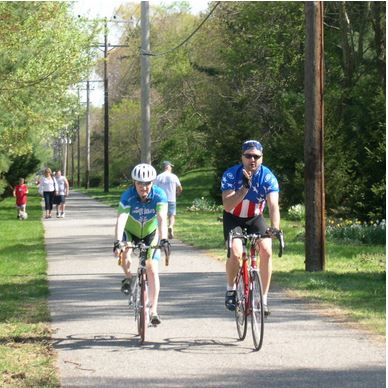
Have Your Say and Help “Walk & Roll Anne Arundel!”
With our boundary expansion, the Four Rivers Heritage Area is excited to include more attractions offering hiking and biking opportunities, and we’ve been highlighting these Recreation Trails among our top “Things to Do.” Yet, there is always room for improvement in our county’s mobility and transportation alternatives. Below, learn more about how you can help Anne Arundel County develop its Pedestrian and Bicycle Master Plan, “Walk & Roll Anne Arundel!”
“Walk and Roll Anne Arundel!” interactive mapping tool will be open to receive public comments from January 25 through March 1, 2022
Anne Arundel County Executive Steuart Pittman and the Office of Transportation released a new interactive web map that will allow residents to submit input for the County’s Pedestrian and Bicycle Master Plan (PBMP), Walk & Roll Anne Arundel! This initial opportunity to provide input on Walk & Roll Anne Arundel! will be available to the public from Jan. 25 through March 1, 2022.
Walk & Roll Anne Arundel! will encompass the entire County and support the objectives of the approved Move Anne Arundel! transportation functional master plan. Move Anne Arundel! calls for safe, accessible and equitable mobility alternatives to motor vehicles in order to relieve traffic congestion, protect the environment, improve health and create a more attractive place to live, work, learn and play.
Walk & Roll Anne Arundel! will be a vision for walking, bicycling, and rolling (by wheelchair, roller skates, scooter, or any other active transportation device) in the County. This network will provide active transportation options for access to work, medical appointments, retail, entertainment, recreation and other services the residents and visitors of Anne Arundel County need or desire.
Over the coming year, the Office of Transportation will work with community members to develop the plan through a variety of outreach efforts, which will assess the current walking and bicycling environment, identify places for walking and bicycling improvements, and create policies and standards for new facilities.
The interactive web map allows residents to provide input beginning January 25, 2022 through March 1, 2022. Residents can “drop a pin” or draw a line on a segment and then comment directly into the map and see what others have said. This will help the County gain insight on where critical improvements are necessary to create a safe, comfortable, bicycle and pedestrian network for all users. The map will allow the public to identify specific locations or roadway segments and provide comments identifying the desired changes or outcomes.
To participate in this important plan development and learn more, visit www.aacounty.org/walkroll. The interactive web map will be available for comment between January 25, 2022 and March 1, 2022. There will also be additional opportunities for input through public meetings held from now until the end of summer, 2022.